Rebuilding Trust: Public Space as Common Ground

By Aidan Coleman

The pandemic has drastically altered society by restricting gatherings, resulting in people flocking to the internet and socializing behind screens. While technology has risen to the occasion to help fill the social void, there’s no question that this widespread shift to online communication has been disruptive and has forced people to adjust. In addition to the mental stresses of the pandemic, civil rights issues and politics have caused a general fear and distrust of those who are unfamiliar. In response, beyond the necessary public realm changes for health protocols, designers must work to create public platforms that will foster rebuilding of trusting relationships in our communities.

 
Public space programmed to allow for active, face-to-face interactions

Public space programmed to allow for active, face-to-face interactions


With the pandemic forcing society to adapt to online communication, we are left largely isolated within our closest social circles. It doesn’t take much experience being online to know that being stuck behind screens all day has negative impacts on our mental health, but there have also been studies on the effects of technology on the human psyche - Dr. Helen Riess is a psychologist who has recently released a book called The Empathy Effect, which describes how the increased communication through text on the internet can damage our ability to feel empathy due to the fact that we can’t see facial gestures or voice tones that should go with our words (Street Roots). It’s no surprise that our dependence on the internet and social media has led to countless misunderstandings that often lead to hostility. The way we, as designers, can catalyze face-to-face interactions is with architecture and programming. Andreea Cutieru describes from her ArchDaily article:

“Social capital refers to the relationships established between social groups in heterogeneous societies, through shared values, trust and reciprocity. Substantial social capital means increased cooperation among citizens, less friction and a keen awareness of the common grounds and entwined fates. Architecture can help build social capital, and numerous design strategies can generate fertile ground for social interaction and various unplanned activities.” (The Architecture of Social Interaction)

While we can’t force people to interact, architecture, with proper programming of the spaces, can provide attractive gathering places that allow people to participate in shared experiences with one another, ultimately encouraging healthy communication.

Studio Gang is an architecture firm that explores many projects and ideas that intertwine architecture and planning with building relationships within a community. They released a booklet in 2016 called Civic Commons that discusses methods for cities to activate their common spaces, and it’s apparent that we need this type of urban planning and design more than ever in 2020. The booklet runs through how to evolve seven types of urban gathering spaces (libraries, parks, rec centers, police stations, schools streets and transit stations) by creating open and comfortable spaces for the community to have diverse experiences while they socialize, work, learn, play, or deliberate. To achieve the goal of trusting others in our community and beyond, we must reshape our urban spaces to allow for comfort and diversity in shared experiences as people come together face-to-face.

 
Civic Commons Master Plan Graphic, by Studio Gang

Civic Commons Master Plan Graphic, by Studio Gang


While evolving civic spaces may seem like a long-term goal that can only be realized after people can gather safely, efforts to transform our environment are already occurring in real time through social distancing. The outdoor realm is being utilized in the practice of tactical urbanism. Pop-up furniture and boundaries reshaped the streets, and in our previous blog on Streetscapes, F+P discussed how easily these temporary street markers could be implemented permanently, allocating more space for pedestrian activity, as opposed to the automobile.

 
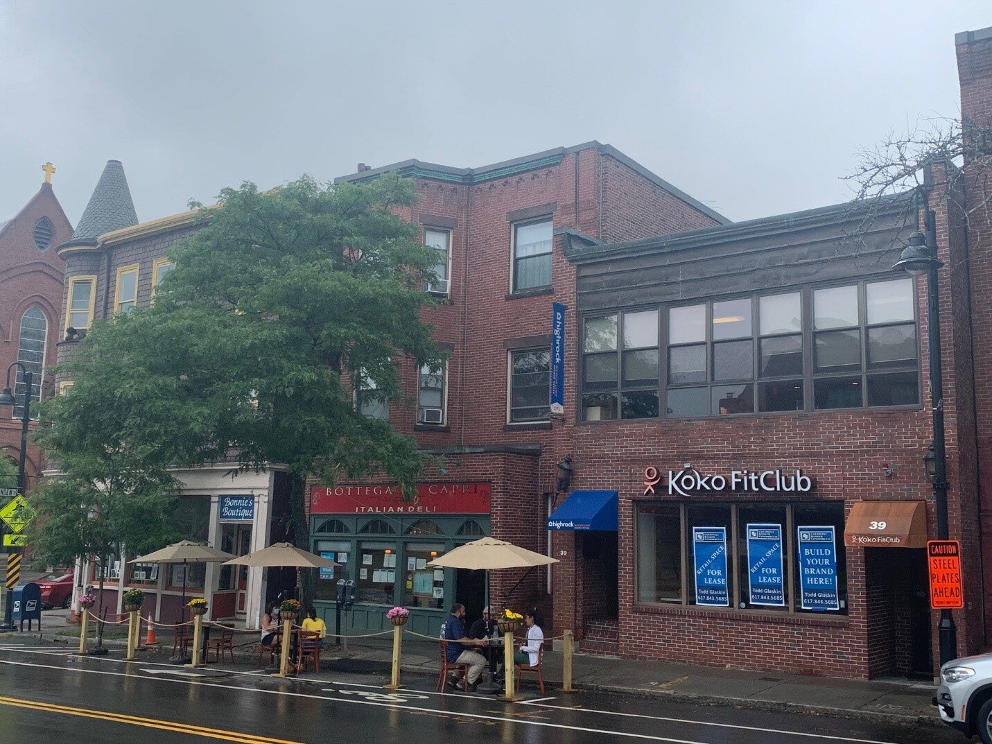
Outdoor dining is a must in our current environment, filling street space with attractive ambiance. Photo by Aidan Coleman

Outdoor dining is a must in our current environment, filling street space with attractive ambiance. Photo by Aidan Coleman


Reorganizing cityscapes for pedestrians is only the first step in evolving our urban spaces to improve public physical and mental health. An important next step in sparking community collaboration and shared experiences is through programming. Even while social distancing, tactical urbanism can be used to block out stage and viewing spaces for performances. When Italy was in lockdown, their viral videos of musicians playing and singing out of their apartment balconies for everyone stuck inside were an uplifting sight. Public art can be a way to bring vibrancy to an otherwise lackluster environment. Vendors can spread out into outdoor pedestrian space to allow for interactive display experiences. Eventually, participation in games/ sports in our larger pedestrian urban environments will literally bring people together. There is even a new movement in urban areas called “guerilla gardening” where individuals take advantage of underutilized spaces and plant varieties of greenery to enliven the area.

 
Dynamic pedestrian spaces created with multiple layers of design elements. Photo by Aidan Coleman

Dynamic pedestrian spaces created with multiple layers of design elements. Photo by Aidan Coleman


While we have been able to temporarily reshape urban areas to make public life work with social distancing for physical health purposes, our social and mental health have taken a back seat. This year has made clear that these issues are also of great importance. As we weather this pandemic, we must design for rebuilding community trust, promoting spaces that offer common ground between strangers for a variety of goals and collaborations.

Sources and Inspirations

  • “Civic Commons.” Studio Gang, studiogang.com/project/civic-commons.

  • Cutieru, Andreea. “The Architecture of Social Interaction.” ArchDaily, ArchDaily, 7 Aug. 2020, www.archdaily.com/945172/the-architecture-of-social-interaction.

  • Green, Emily. “How Technology Is Harming Our Ability to Feel Empathy.” Street Roots, Street Roots, 20 Feb. 2019, www.streetroots.org/news/2019/02/15/how-technology-harming-our-ability-feel-empathy.

  • “Polis Station.” Studio Gang, studiogang.com/project/polis-station.

  • Zilliacus, Ariana. “Studio Gang Creates 7 Strategies to Reimagine Civic Spaces As Vibrant Urban Hubs.” ArchDaily, ArchDaily, 27 Sept. 2016, www.archdaily.com/795905/studio-gang-creates-7-strategies-to-reimagine-civic-spaces-as-vibrant-urban-hubs.
Leveraging Resources to Foster Positive Change through TAPS

In February 2020, Form + Place Principal, Michael Wang, co-chaired an Urban Land Institute [ULI] Technical Assistance Panel [TAP] in Wareham, MA.  The team analyzed the village center and waterfront area, and made recommendations for zoning changes that would facilitate mixed-use development, increase residential density and revitalize the public realm. As a follow-up to our blog post from earlier this year, we wanted to share links for the ULI TAP report, which was recently published. In addition, a recent article in the Wareham Week indicates that the Town is already implementing some of the recommendations of the panel, including changes to zoning in the village center. 
 
F+P’s original blog can be viewed below.


Wareham Village Technical Assistance Panel (TAP)

An Interview with Form + Place Principal, Michael A. Wang

Written by Gillan H. Wang

PRESENTATION DIAGRAM, ULI TAP, WAREHAM VILLAGE 2020

PRESENTATION DIAGRAM, ULI TAP, WAREHAM VILLAGE 2020

I.                 The term “TAP” may be unfamiliar to people outside of the A/E/C industry.  What is a TAP and how does it work?

Technical Assistance Panels (TAPs) are essentially a day-long problem-solving charette facilitated by the Urban Land Institute (ULI) and often sponsored by MassDevelopment.  The TAP process involves engaging a panel of a diverse professionals to evaluate a particular challenge(s) that a town wants to address, and they offer informed and unbiased recommendations that can often provide a road map for a community to attract targeted private investment.  Panelists typically include architects, landscape architects, civil engineers, real estate developers, land use attorneys, as well as representatives from MassDevelopment, who bring expertise in financing and implementation strategies.

To be considered for a TAP, towns submit an application to the ULI Real Estate Advisory Committee, which determines whether the issues in fact merit exploration.  For example, a town may want to address economic development challenges (vacancies) in their village center brought on by large format retail development on its periphery that draws people away from downtown, or a city might want to reconnect its Main Street with a potentially desirable waterfront area that has been cut off by modern infrastructure.  Each case is unique. 

Once a TAP is approved, co-chairs are selected and the Committee works to assemble a diverse group of panelists based on the nature of the problem (e.g. transportation, parking, zoning, blight, environmental issues, lack of density, etc.). Ultimately, a panel of 7-8 people is identified, which collectively provides a rich range of expertise. 

 
PANEL OF EXPERTS, ULI TAP, EAST MILTON 2019

PANEL OF EXPERTS, ULI TAP, EAST MILTON 2019


II.               What are the advantages to a town of utilizing the TAP process?

While development can follow many tracks, building community consensus is a key piece of the equation. A proactive town can work diligently to put forward a clear vision for redevelopment by holding community outreach meetings and developing an implementation strategy. Alternatively, a developer may see an opportunity and attempt to build buy-in from community stakeholders. But, both of these approaches can take considerable time and resources, especially if a municipality does not have consensus regarding its priorities.

The TAP process is unique in that it allows communities to solicit neutral professional advice from outside experts, which town leadership can then use to help focus priorities and expedite implementation.  This can be advantageous when towns find themselves “stuck” on a particular issue.  In a recent TAP in Wareham, MA, for example, the town’s Redevelopment Authority had been utilizing considerable resources on the redevelopment of a former mill site that was outside the core village area. While there was a clear vision to provide a community meeting center, the location was not conducive to driving revitalization of the Main Street corridor and waterfront, which the panel determined to be the necessary focus. So while the town had identified the need to proactively pursue the redevelopment of a catalyzing project, they were not putting their time and resources into the most critical effort.

III.              What sparked your interest to participate in the Wareham TAP?

When the issues were introduced at a Real Estate Advising Committee meeting, the questions about how to revitalize a struggling Main Street corridor spoke to me – and the unique community building issues that Wareham has identified strongly parallel my professional interests, and those of Form + Place. Helping communities to vision how to reinvent themselves through targeted mixed-use development and place-making involves understanding their challenges and figuring out how to leverage their assets – it’s a big puzzle! In this particular project, zoning was one critical piece of the equation, as it was determined that bringing more residential density into the center would be an underlying driver of redevelopment opportunities. And while density can be an important building block, there also need to be usable public spaces for community events and gathering – another component clearly missing in Wareham’s village center.

IV.             Describe the Wareham Village TAP

For the Wareham TAP, I was a co-chair with Jim Heffernen, a land-use attorney and real estate developer. Wareham has a Main Street corridor lined by 1-3 story shops, some of which are vacant.  On one side of the street there is a reasonably continuous facade, and the other side of street features mostly free-standing structures/businesses (a post office and a bank with a drive-through). On the side of the street with the continuous façade, there is an unattractive back alley and train tracks that separate the Main Street shops from a potentially attractive waterfront area. Essentially, the challenge Wareham faces is how to connect Main Street to its waterfront asset and create a vibrant village experience.

A large part of the recommended solution was to focus on the back alley (“Merchant’s Way”), including making a one-way street with thoughtfully designed and landscaped parking, allowing for the redevelopment of a buffer zone along the back of the main street buildings. Ideas included promoting a pedestrian-friendly environment through outdoor dining, accommodated on terraces overlooking the water. In addition, changes to zoning could promote denser residential development, both on town-owned lots and on the upper levels of existing Main Street buildings.

In addition, a multi-faceted approach to place-making was seen to be another critical ingredient to address, including making improvements to streetscapes, providing a significant public space and rethinking pedestrian mews to create attractive connections to a more accessible waterfront.

 
WALKING TOUR, ULI TAP, EAST MILTON 2019

WALKING TOUR, ULI TAP, EAST MILTON 2019


V.               How did your panel arrive at this solution?

The typical TAP requires a 12-hour day, and some preliminary base documentation is assembled by the municipality for review by panelists ahead of time. Here is a typical schedule:

  • Meet town leaders over breakfast meeting (1 hour)

  • Tour of the site / town (1 hour)

  • Stakeholder interviews (2 hours)– residents, business owners, property owners, neighborhood associations, etc. (not including town officials or staff)

  • Panel brainstorming session (5-6 hours) distillation of feedback and impressions of assets and challenges; Develop recommendations and implementation strategies; Prepare graphics and power-point presentation

  • Presentation to general public and town leadership; Q&A (2 hours)

  • Final report published (at a later date)

VI.             How often do TAPs produce built results?

ULI recently commissioned a survey to determine the effectiveness of the Technical Assistance Panel program. This report, which will be released to the public shortly, shows that many communities have followed recommendations put forward through the TAP process and that implementation strategies identified have helped unlock opportunities and led to considerable economic development successes in municipalities across Massachusetts.

VII.            What have you learned from participating in this process?

Each municipality has its own set of unique variables, but there are a surprising set of common themes found across all communities. People are wary about increases in density and, instead of perceiving it as an economic driver, often fall back on fears of adverse impacts to their lifestyle, including on schools, infrastructure and traffic.

Many towns lack a diverse range of housing options, particularly reasonably priced product for young professionals and housing for the over-55 demographic, who want to downsize but remain in their community.

Strong leadership is a key component to implementing positive change in towns. Having a strong planning and community development staff can certainly help as well, especially when it comes to helping to develop a common vision, securing layered funding resources and being proactive in making key sites development-ready. The TAP program is a unique tool available to communities, not only for helping focus priorities, but for identifying implementation strategies.


Streetscapes: An Opportunity for Re-Visioning our Cities

By John Rufo + Gillan H. Wang

In the recent NY Times Opinion piece about the benefits of banning individually owned cars in Manhattan, Farhad Manjoo touts the merits of wider sidewalks, more efficient public transit, healthier living, and generally more desirable public spaces that enhance and celebrate the pedestrian experience.  The folks at the Practice for Architecture and Urbanism (PAU) have put together a very compelling visual and written argument for people taking back the streets of New York City. At Form + Place we have been thinking about how the Pandemic is shaping the way we use the spaces surrounding our homes, schools, and places of business. The picnic tables on the town common and pop-up outdoor restaurant seating on sidewalks offer a glimpse of a future streetscape that could be more appealing and socially inclusive.  While we expect that vehicular traffic will ultimately return in most communities, it is worth giving some critical thought to the inherent possibilities of a re-imagined streetscape.

 
Pedestrian streets creating a place for dining, shopping and strolling

Pedestrian streets creating a place for dining, shopping and strolling


Already familiar with a handful of places (in Boston and beyond) that have closed off former streets to vehicular traffic, we know the joys of strolling and dining in the resulting bustling urban centers. Pedestrians brushing up against diners, people jostling with bicyclists, and goods brought out from shops to optimize their visibility and appeal, all contribute to a sense of vitality, which in turn draws crowds. This is an effective method to continue to employ as we re-vision our cities. In addition, guideline resources such as Complete Streets codify proven successful design interventions such as parklets and curb extensions.

 
Parklets

Parklets


Curb Extensions

Curb Extensions


Some will argue that parking spaces are a valuable commodity and the lifeblood of already precariously poised retail venues in small downtowns and villages. However when it comes to the ends of blocks where restaurants are often sited and where street crossings are most encouraged, the sheer volume of people and activity suggest that visible curb extensions, textural changes to paving, lighting accents and increased signage are all important parts of traffic calming and establishing pedestrian-focused hierarchy.

By applying this model to Newbury Street in Boston, or a suburban town center like Needham, it isn’t hard to imagine a different reality where a larger portion of the street is dedicated to pedestrians, dining and other activities rather than to moving and storing cars. The creative spontaneous response during the COVID crisis where small portions of “streets” are reclaimed for other uses has functioned as a real-time experiment, allowing us to easily imagine our typical street a little differently. Replace the jersey barriers, the traffic cones and temporary galvanized railings with design elements of the same function but better aesthetics, and the street quickly becomes a new kind of enjoyable place to dwell in and share.

 
Photos of Newbury Street and Needham Center

Photos of Newbury Street and Needham Center


Sketches over the above photos showing how easily the streetscape might be improved

Sketches over the above photos showing how easily the streetscape might be improved


Historically, it is only in the course of the last century that the street has come to be dominated by the presence of the privately owned automobile. In ancient and medieval times streets were mostly narrow pathways between buildings, places to route water, goods and sewage, where crosswalks were constructed as literal river crossings.

 
Typical medieval streets and the ancient roads of Pompeii

Typical medieval streets and the ancient roads of Pompeii


The striking juxtaposition of photos of Park Avenue in NYC at the turn of the century and today (as seen in Manjoo’s NY Times article) is a dramatic accounting of good intentions gone awry by changing values. This is a perfect moment in time to reevaluate our intentions for the built environment of the future.

 
Evolution of Park Avenue

Evolution of Park Avenue


In many European cities, the “sidewalk” and “roadbed” are often barely distinct from one another, beyond a subtle change in paving. This reinforces an understanding that the street is a dynamic entity that can be re-purposed as needs dictate, and this idea is particularly intriguing.  Could the future of our thoughtfully planned streets allow for the capacity to be literally dynamic?  Imagine a boulevard with limited vehicular traffic (perhaps busses and bikes, as PAU describes in their proposal for NYC) which would allow for restaurants and shops to engage the public more directly, and support increased amenities for the passer-by.

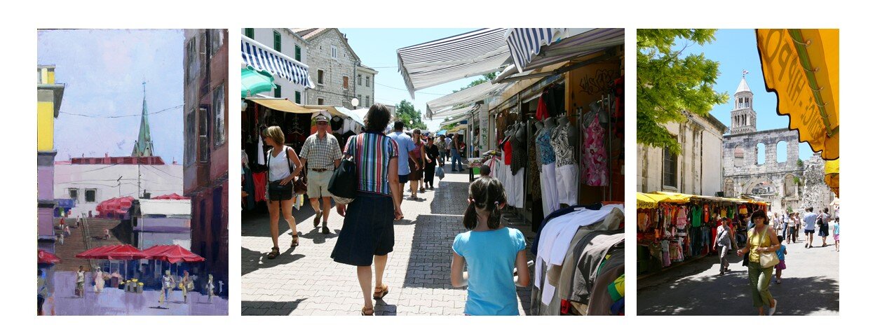
Traditionally the boundary between a street and a market is more implicit than explicit.  An open market can take over a street at certain times a day with the barkers calling out to pedestrians.  At night shops shutter their doors and restaurants take the stage, extending their indoor atmosphere and alure to the world of the street.

 
Examples of streets with dynamic edges

Examples of streets with dynamic edges


At a moment when our commuting patterns have been adjusted, our emphasis on public gathering has been refocused, and we are poised to embrace equity in transportation, it’s important to see the temporary adjustments we’ve made to our streets as a first step toward a better design for our towns and cities. Yes, there will still be cars and stop lights and parking meters, but if a larger portion of the street is dedicated to pedestrians and activities of a more human scale, we can humanize our built environment a little more fully, reclaiming some of the real estate lost to our cars and creating a more equitable ownership of the public realm.


Additional sources of inspiration for this post and things we are enjoying reading include:

The Power of Public Spaces

By Michael A. Wang

Photo 1.jpg

The importance of urban public spaces has never seemed greater than during our current times, as we see people seeking out venues, not just for health and recreation but, to have their collective voice heard. According to Charlie McCabe with the Trust for Public Land, public funding for city parks hit $8B nationwide in 2019. While public investment in parks has shown a steady growth in recent decades, history reveals that periods of economic challenge, such as the Great Recession of 2008, can often divert funding from this critical piece of urban infrastructure. The National Recreation and Park Association [NPRA] notes that city spending on public parks plummeted in 2008 by 22%. Despite our current challenges, now is certainly not the time for disinvestment.

 
Bryant Park, NYC

Bryant Park, NYC


The Trust for Public Land states that there should be “a great park within a 10-minute walk of every home, in every neighborhood, in every city across America.” Parks are a platform for equity and as cities begin to formulate urban design goals to address the new realities of the COVID – and, hopefully, post-COVID - world, it is essential that open space remains a priority. This will involve creative approaches to the financing and designing of new parks, as well as new theories for maintaining and repositioning existing assets. Key to the preservation of local parks will be the engagement and empowerment of members of the local community. Allowing a significant degree of self-determination can infuse creative placemaking through the integration of local assets and the celebration of unique cultural influences.

 
Outdoor dining enlivening a narrow street & occupying a “bump out” for dining

Outdoor dining enlivening a narrow street & occupying a “bump out” for dining


One could argue that investment in urban streetscapes will play an equally important role in shaping the economic and cultural well-being of our communities. Many cities are already focusing on expanding bicycle networks and creating more generous pedestrian environments, but this will be more critical than ever as outdoor dining and outdoor retailing seemingly become an essential component to the survival of local businesses. In denser urban contexts where tighter street sections may not allow as much flexibility, cities need to get creative and encourage, for example, the use of pedestrian mews and repurposed on-street parking spaces to provide necessary venues for businesses. The periodic, or permanent, closure of certain streets is another strategy worth exploring, as this can instantaneously create vibrant pedestrian-only environments. If utilized creatively, the changing geometries of a city grid can often create opportunities for small, uniquely shaped parklets.

 
Closing streets to vehicles can create lively pedestrian environments

Closing streets to vehicles can create lively pedestrian environments


Form + Place is currently working with the City of Springfield’s Office of Planning and Economic Development to re-envision the Northeast Downtown District, a neighborhood that was impacted by a natural gas explosion in 2012 that caused widespread damage. Despite being strategically located within walking distance of the downtown core, the new MGM casino and a revamped Union Station, the district has struggled to implement redevelopment. While there is burgeoning interest in integrating more market-rate residential density, the City is proactively contemplating steps to make key public realm improvements. UMass Amherst students in the Department of Landscape Architecture and Regional Planning’s master’s program recently completed an analysis of the district that led to a series of proposed interventions. A common theme that surfaced in every proposal was the importance of the public realm as the unifier of people and place. Building on this theme, Form + Place has implemented a multi-pronged approach to explore the feasibility of catalyzing mixed-use residential development on key parcels while, simultaneously, examining improvements to important commercial corridors, rethinking existing public spaces and contemplating the potential future integration of a major public park.

 
Narrowing a street in Springfield, MA to expand the pedestrian environment

Narrowing a street in Springfield, MA to expand the pedestrian environment


UMASS Amherst LA&RP Studio project linking Springfield neighborhoods with open space systems

UMASS Amherst LA&RP Studio project linking Springfield neighborhoods with open space systems


Whether focusing on the connectivity of urban neighborhoods or providing flexible open spaces for communal use, it is essential that cities avoid disinvestment in the public realm, as this is a critical component of attracting private redevelopment dollars. There is no doubt that current challenges will cause some residents to retreat from the city, but dense and diverse urban communities will remain and continue to grow, as the world’s population shifts towards urban living. As such, evolution in the design of public spaces will be more critical than ever for supporting a desirable quality of life. Incorporating a variety of flexible, usable public spaces will be a key aspect of thoughtful community-building, but it is also worth noting, as Theaster Gates so eloquently posits in 9 Principles of Ethical Redevelopment, “Place is more about the people who inhabit it and the activities that they engage in than the space itself”.

 
Photo 9.jpg
 

Mindful City Building through Creative Placemaking

By Michael A. Wang

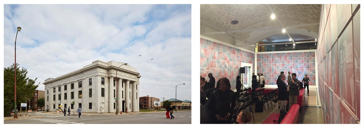
I recently participated in an Urban Land Institute [ULI] forum in Chicago on Implementing Creative Placemaking [CPM]. CPM is an innovative approach to placemaking that strives to integrate art and culture, along with great design, into real estate development projects early in the process. This two-day forum, which brought together developers, architects, planners and others from across the United States, took place on the South Side of Chicago and included an enlightening tour of the Grand Crossing neighborhood where Theaster Gates, an artist and professor at the University of Chicago, has been leading a unique community rebuilding effort.

Theaster Gates’ Stony Island Arts Bank, Grand Crossing Neighborhood, Chicago, IL

Theaster Gates’ Stony Island Arts Bank, Grand Crossing Neighborhood, Chicago, IL

Gates’ revitalization projects are the essence of Creative Placemaking, as his approach focuses on a process and values that are best described as mindful city building. This process actively engages members of the community to make conscientious interventions that find beauty through the repurposing of existing physical, cultural and social assets that are latent.

Forum participants were asked to contemplate how Creative Placemaking as a tool could become more accessible to the traditional development community, which is often more driven by return on investment. Among the barriers discussed were those that could be categorized as related to “time”, “language” and “trust”. With respect to time, Gates’ approach argues that one might “slow down to go fast”, thereby engaging in a more collaborative process that results in empowerment and mentoring. Traditional development tends to assume that “time is money” and, therefore, has an aversion to unknowns, including unpredictable approvals processes and zoning challenges, that can impact tangible returns.

Theaster Gates sharing his Dorchester Avenue projects in the Grand Crossing neighborhood

Theaster Gates sharing his Dorchester Avenue projects in the Grand Crossing neighborhood

“Language” can be a barrier as well, with the development community likely hesitant to incorporate Creative Placemaking tenets that they do not fully understand. Similarly, it can be challenging for artists and aspirational members of the community to fully comprehend the language of development and what is involved in navigating typically complex approvals processes.

“Trust” is perhaps the largest hurdle. Developers are often demonized and not given credit for the risks they are taking. Achieving community buy-in can often be challenged by NIMBYism and the fear that one’s neighborhood will be gentrified – physically and culturally – leading to displacement. Figuring out a mechanism to not only empower members of the community but to provide them with a means to realize some of the gain from revitalization efforts should be a continued focus.

Repurposing found resources and creating cultural gathering places

Repurposing found resources and creating cultural gathering places

Creative Placemaking holds tremendous potential to “lift all boats” when done thoughtfully. Digging deep to uncover a community’s essence and finding a way to incorporate cultural, social, historical aspects – through providing venues for performing arts, visual arts, gathering, etc. – can also have notably positive impacts on the traditional development bottom line. How can this be achieved? This is not solely a matter of educating the development community regarding the processes and benefits of integrating Creative Placemaking, it requires communities to be proactive in establishing reasonable approvals processes that offer incentivizes. This can take the form of expedited permitting or tax incentives or zoning relief such as density bonuses, to name a few.

When done well, Creative Placemaking holds tremendous potential to truly revitalize the full spectrum of communities – even those that are significantly disenfranchised – because it is founded on utilizing the existing resources of a place, including its human capital. Just as cities continue to evolve over time, mindful development can be a platform for ensuring the longevity and authenticity of place.


 Reference:          Theaster Gates, Ethical Redevelopment: Arts + Culture Build Cities

KidsBuild! 2019: Reflections on Our Passion for Shaping Cities

By Gillan H. Wang

Form + Place was pleased to participate in KidsBuild! - a family program that is organized and run by the Boston Society of Architects (BSA).  The two-day event is designed to bring awareness to children and their families about the steps involved in realizing new buildings. It also aspires to promote active community discourse in the planning and development of our cities.  This event highlighted numerous aspects of our work that we particularly relish – engaging with the community, a collaborative process, creative problem solving, bringing ideas to fruition, and ultimately enhancing our built environment and public spaces. 

KidsBuild! City Grid in the BSA Lobby

KidsBuild! City Grid in the BSA Lobby

KidsBuild! Structure

An imaginary city grid is laid out in the lobby of the BSA, with empty parcels mapped out. Families select a building type and site and then must obtain a building permit for their structure.  They are required to consider zoning rules (primarily building height) and then design and select materials for their building.  They then proceed to the Construction Zone where volunteers assist as needed in the assembly of their structure. When their building is complete it is placed on their site in the city grid where it is reviewed for inspection, rewarded for the integration of sustainable design features, and granted a Certificate of Occupancy. It was impressive to see how many families made “green” choices, for which they were awarded a green seal, in addition to a C of O.

KidsBuild! Site Selection, Construction Zone and Finished Product

KidsBuild! Site Selection, Construction Zone and Finished Product

Engaging with the Community (Site Selection)

The earnestness with which the children considered not only their options for sites and building types, but also the context in which their structures would sit was endearing.  Our office group volunteered on a Sunday, so a number of sites had already been claimed and built. It was striking to see how keenly aware the children were of the buildings adjacent to their sites.  Their ability to imagine this city as a real entity with endless possibilities was refreshing.

Empty Sites Adjacent to Built Structures

Empty Sites Adjacent to Built Structures

At Form + Place we enjoy the process of working with developers and communities to determine the appropriateness of development proposals for specific contexts.  Listening and sharing ideas and experiences to optimize the maximum potential of each site never gets old. In working as the Peer Reviewer for the City of Newton on the Northland development, we continue to track changes to the initial proposal, many shaped by community input.  While the original mixed-use concept included more dwelling units and retail space, it was decided that a reduction in overall square footage would be preferable.  The scaling back, particularly of retail, will result in less traffic, especially when combined with alternative transportation modes that are being promoted.


A Collaborative Process (Zoning)

Rules give structure and prevent chaos.  The need for this was readily apparent at KidsBuild! where children might have been tempted by the endless assortment of donated materials and an inclination to build the biggest and most impressive building.  Zoning gives a measure of calculated control, which factors in the needs of the larger community. Children consulted building height measuring charts to determine the maximum height for their structure, according to the building type and zone (Industrial, Public, Residential, Commercial), and seemed to readily accept adhering to a prescribed limitation for the greater good.

Materials Yard

Materials Yard

Norms and standards are extremely helpful, and occasionally rules need to be adjusted and updated to reflect change. In our recent work with the City of Newton, we have helped refine the Zoning Redesign initiative by facilitating input from other design professionals and the general public. Much of Newton’s built environment predates its zoning and therefore a high percentage of parcels in both village and residential districts are non-conforming. Modifying zoning can help strengthen communities by facilitating appropriate economic development, creating a more holistic and vibrant public realm by promoting contextual design.

Newton Zoning Redesign Process Boards

Newton Zoning Redesign Process Boards

Creative Problem Solving (Design)

“Let’s go draw.  We need an idea.” This statement was heard throughout the day at KidsBuild! and it caught our attention because it speaks directly to what we enjoy doing as architects.  It describes how we think, problem solve, and how we collaboratively engage in conversation with our clients.  

Form + Place’s master planning work in Winthrop over the past four years has helped to create a “vision” for what the future of this community could look like.  Diagrams that have analyzed urban connections and placemaking opportunities, combined with renderings and feasibility studies exploring the redevelopment of key sites in the core, have helped uncover the potential for an exciting new public realm that Winthrop is beginning to implement.

Winthrop Vision Studies

Winthrop Vision Studies

Realizing Ideas (Construction)

“We need grass!” This was the mantra that echoed through the Materials Yard.  Anything that could represent grass (fabric, felt, green rubber material, bits of AstroTurf) was quickly snatched up.  While many of the children were focused on details that they thought were of paramount importance (making sure they had something to represent the books in their library, the right string for the swing in their backyard, and baked goods for the bakery), ultimately they were faced with the challenge of constructing a building that would stand erect and hold together using glue sticks and packing tape. The enthusiasm of the children was a delightful reminder of the excitement of the creative impulse.  Sometimes architectural detailing can seem tedious, but to craft thoughtful solutions to technical problems requires a commitment to creative problem solving.

Details of Goodwill Industries at The Shops at Riverwood in Hyde Park

Details of Goodwill Industries at The Shops at Riverwood in Hyde Park

Enhancing our Built Environment and Public Spaces (Completion)

The moment of realization is what we all look forward to, and ultimately it is the reason we undertake design problems. At KidsBuild! it was thrilling to see family teams carry their finished project to their sites and seek approval from an Inspector. This generally involved the children describing their buildings and the decisions that they made in creating their structures. The finished KidsBuild! city was a spectacular manifestation of collaborative effort, chock-full of well thought out structures and spaces.

Seeing the MGM Springfield project open in 2018 was similarly thrilling.  Beyond the celebratory opening, however, it is especially exciting that the project realized a vision to reinvigorate the downtown of a historic city that has “great bones”.  The combination of historic preservation, a revitalized public realm and a catalyzing combination of uses make this mixed-use entertainment facility a key economic engine for the future of Springfield. 

MGM Springfield and the Revitalization of Main Street

MGM Springfield and the Revitalization of Main Street

Our passion for shaping cities drives our commitment to the collaborative process, and it was fun to be surrounded by collaboration at the KidsBuild! event. We believe that it takes a village to produce well thought out buildings and places that work for all. The BSA’s emphasis on community building at their wonderful family program resonated with our team as it underscores an important part of our firm’s mission.

"Form Follows Place" - Public and Private Roles in Visioning East Milton Square

By Michael A. Wang

I recently had the opportunity to co-chair a day-long Urban Land Institute Technical Assistance Panel [TAP] that contemplated the future of East Milton Square. This neighborhood center is one of only three business districts in a community where commercial uses contribute a mere 3.8% of the Town’s tax revenue. While East Milton Square has very passionate and engaged neighborhood stakeholders, it remains a village center that is characterized by physical barriers – most notably, it is bisected by I-93 – that present challenges to its walkability and overall cohesiveness.

Aerial of East Milton Square & Proposed Manning Park Redesign

Aerial of East Milton Square & Proposed Manning Park Redesign

The 2015 Milton Master Plan championed the introduction of mixed-use development into the Town’s commercial cores to expand the diversity of housing types and, in turn, to stimulate the integration of more commercial and civic amenities. Creating a “Vision Plan” for each of these districts through a process that effectively engages residents and local business owners would certainly be an excellent first step.

 In recent years, a great deal of focus has been directed towards renovating the Manning Community Park, which sits atop a depressed southeast expressway. While a thoughtful redesign of this significant open space, including more pedestrian-friendly connections across the busy surface roads of Granite Avenue and Bryant Avenue, will make this park more usable, it may never become the “center of gravity” for the district given its perch above the highway. In fact, one of the ULI panel’s primary conclusions was that the Town might want to consider expanding its Business District to the east of the highway along the Adams Street corridor as it reaches out towards the Quincy line.

Rethinking East Milton Square’s Business District

Rethinking East Milton Square’s Business District

One key question for any community contemplating the revitalization of a commercial core is how to be proactive in promoting the kind of development that is compatible with the surrounding neighborhood. When thinking about the critical role of public-private partnerships in this equation, community leaders should not only look at what incentives would attract private investment but, also, what improvements the public sector could make to enhance placemaking potential.

 The Town of Winthrop is doing just this, as they take concrete steps to implement their 2017 Center Business District [CBD] Master Plan. This plan, authored by Form + Place in conjunction with MassDevelopment and the Metropolitan Area Planning Council [MAPC], identified a long list of action items for the Town to address, including improvements to infrastructure, the rethinking of the “connective” role of public open spaces and changes to zoning regulations that would stimulate appropriate mixed-use development.

Revitalizing Winthrop’s public realm

Revitalizing Winthrop’s public realm

Regardless of which community, ensuring that there is an understandable and reasonable approvals process in place is essential for attracting quality private development. But, as evidenced by recent resistance to proposed mixed-use development in East Milton Square, having a community vision in place that local stakeholders have already bought into is equally important. Embracing local developers who share in the vision and have a first-hand understanding of the community is often likely to yield more contextually-sensitive proposals. Larger national developers, however, are often the ones who may have the resources to withstand lengthy approvals processes and this may result in more formulaic development solutions.

 A well-conceived “Vision Plan” can create a road map for public investment in a key mixed-use commercial district. Identifying placemaking goals that promote a safe, walkable center is a logical starting point for any community. Whether integrating the tenets of Complete Streets, identifying new public open space for a range of active and passive uses or incorporating design guidelines that shape how buildings interface with the ground plane, there is so much that communities can do to shape the character of their commercial centers. Proactive community investment in the public realm and infrastructure, more often than not, will serve as a huge catalyst for the influx of private development dollars.

*Use this link http://milton.vod.castus.tv/vod/?video=80ee396d-5f0f-467e-b6ac-a246ff666808 to see the full Milton TAP presentation starting at minute 10.

Completing the Picture with Art and Great Events: Placemaking in the Hospitality World

By John Rufo

“Well conceived and harmonious spaces allow people to relax, to be present in the moment and to enjoy themselves. Meeting people where they are is really important.”

- Andrea Finard, Harbor Hotel Co-Owner

Last weekend we journeyed to Provincetown for a reception of the art exhibit “Ocean Allure” at the Harbor Hotel. The hotel is owned by friend and client, Todd Finard, who conceived of the exhibit, along with his wife, Andrea. The hotel regularly hosts art events, and in this show they wanted to change the vibe of the main public spaces and create some buzz around the theme of the hotel’s oceanside setting and the significant role of art in the Provincetown community. Andrea Finard explained, “we ask ourselves what might make this experience better, more fun, or memorable - vacation time is finite. This season, we worked with 4 talented artists (John and Caroline Rufo, Edgar Stewart and Thanassi Kuliopulos) whose artwork had a really strong synergy with the environment that the hotel strives to provide.  Guest feedback has been overwhelmingly positive.” The reception served to catalyze interest in both the season-long art show and the hotel, but what I hadn’t quite imagined was the degree to which the art and the location could work together to heighten the experience of place.

combo+1.jpg

The hotel (really a motel originally) was built in the 50’s when the allure of the road and a new national highway system was the thing that mobilized America to get out and see the country. When they bought the hotel in 2011, the Finards and their partners renovated it, “peeling back the 60’s, 70’s, 80’s and 90’s architecture that covered over and all but made invisible the original mid century modern vibe”. Branded now as a “retro glam hip hideaway”, the main public spaces – reception / library / bar / restaurant - convert easily into a welcoming art gallery that is both intimately scaled and expansive as it opens dramatically to an outdoor fire pit and sweeping views of Cape Cod Bay and Provincetown Harbor.

Image+7-29-18+at+2.34+PM.jpg

The owners of the Harbor Hotel understand the potential for art and space to meld, in order to connect with the local community. At Form + Place we approach placemaking as both an extension of the building realm and a wholly public undertaking that embraces the power of art and thoughtful programming to provide purpose and meaningful focal points in public spaces. Art in the placemaking continuum works at many scales. Whether it’s fine art, performance art, sculpture, wall murals, etc., it pushes the conversation beyond the site and building to engage cultural and social aspects of the community.

Combo+2.jpg

As a painter, I love to marry art with the local community in a way that rings true, and within our firm, we feel the same way about architecture. Designing buildings is a rewarding and creative process, but experiencing them and engaging with the community in a space that facilitates connectedness, is one of architecture’s higher purposes, and a driving force at Form + Place. The Finards embrace the importance of creating unique experiences that ground the “getaway weekend” in good placemaking, good food and great events. “When it comes down to it”, says Todd, “carefully curated art creates a new level of placemaking that accentuates the space and reinforces our brand, all while heightening community connections”. The day before the "Ocean Allure" reception happened to be Gallery Night in P-town. Commercial Street was electric with conversation and noise that spilled out of the galleries and beckoned people into the restaurants, pubs and cafes.

Combo+3.jpg

Of course, this experience is common in P-town, which is sought out for its art, and therefore all visitors are sure to take in a healthy dose of fine art. The location of the Harbor Hotel at the east end of Commercial Street is ideally suited to extend that gallery experience. The bar and fire pit create a kind of wide open venue that is quite a contrast to the tighter spaces of Commercial Street deeper in the East End gallery district. The setting of the Harbor Hotel has a way of luring you in to pause and reflect on the visual stimulation that is Provincetown. Maybe that’s the most important role of features like fire pits and public art; whether it’s in an urban context or at the edge of the bay, stopping to breath and consider the things you did and saw that day is one of the important experiences of getting away.

Bay View Rooms along hotel's front facade

Bay View Rooms along hotel's front facade

It will be interesting to see what the next stage of evolution is for the Harbor Hotel’s placemaking aspirations. One could imagine a different kind of front door / street edge to the property. Maybe one that prioritizes place over parking while softening the experience of the customer moving from the hotel to the water’s edge. The extension of the lobby /gallery / bar spaces into the fire pit with the vista of the waster beyond is so successful and alluring… the potential, like the view, is almost endless!

IMG_4016.jpg

Technical Assistance Panels: The Power of Teaming ULI, Professional Expertise and MassDevelopment

By Michael A. Wang

Among the diverse initiatives that the Urban Land Institute and MassDevelopment champion to help communities across the Commonwealth, the day-long Technical Assistance Panel [TAP] charrette is one of the most engaging for panelists and stakeholders alike. The December 12th TAP in Ashland, MA, co-chaired by Michael Wang of Form + Place and Jamie Simchik of Simchik Planning and Development, brought together professionals possessing a wide range of expertise from land planning, architecture and landscape architecture to market analysis, environmental permitting and the real estate development world.

The Ashland TAP, not unlike recent panels in other Massachusetts communities - such as in Yarmouth, Dedham and Leominster - was a 12-hour brainstorming session that asked panelists to tour the focus area, review documents [recent studies, zoning, etc.] and conduct a series of interviews with the goal of addressing a few key questions posed by Town leadership. In Ashland’s case, experts were asked to make recommendations for how the Town might stimulate economic development in a downtown that already has a variety of assets, including a collection of architecturally distinct buildings and a surrounding area rich in natural resources – river, parkland, etc. Ashland does have some fairly unique challenges, however, ranging from an active commuter rail line that bisects Main Street on grade, a commuter rail station relocated outside the typical “walkable” TOD radius, and some environmental concerns stemming from a nearby Superfund site.

Photo+4.jpg
Photo 5.jpg

As with many outer-ring suburban communities, revitalizing the core often centers on the need to create a “there” there. Among the recommendations that the panel put forward, the incentivization of multi-family residential development in the downtown – ideally in a mixed-use equation – was identified as an essential driver. But attracting a critical mass of people to live in the core clearly requires a holistic vision for what downtown Ashland can become. The Town is currently studying how improvements to the streetscapes can simultaneously improve traffic flow and create a more pedestrian-friendly environment. The panel felt that revisions to the zoning that would promote development patterns to reinforce the definition of street walls [continuity], create opportunities for more density and facilitate a diverse mix of uses [i.e. restaurants/coffee shops] would go a long way towards attracting private investment. This must happen in conjunction with improvements to infrastructure and thoughtful consideration of how to reshape the public realm to allow for the integration of memorable spaces that can be programmed for active and passive use.

Technical Assistance Panels can be a key stepping stone and present a rare opportunity for communities to gain insights from a group of experts that do not have any specific allegiance to their community. Often local efforts get bogged down by the anti-development sentiments of a few outspoken stakeholders who spread fears of the potential disastrous impacts on school systems, traffic and parking. In many cases, studies have shown that these concerns are unfounded or can be reasonably mitigated.  With a number of key development parcels already under Town control, Ashland is in a good position to push forward a catalyzing project or two.  Partnering with private land owners who have significant holdings in the downtown will be an essential component to bringing Ashland's vision for a new town center to fruition.

Sketch Diagram of Key Opportunities from TAP Charrette

Sketch Diagram of Key Opportunities from TAP Charrette